
I worked for five years (1974-1979) doing aerial photo mapping from stereo air photography, for Kucera and Associates and Continental Air Surveys. This is one of the analog machines I used to use to view stereo pairs (3d models, overlapping air photos) and draw contour relief maps to support civil engineering and mining operations. This is the Wild A8. I also worked on the Kelsh stereo plotter, the Wild A10, and the Kern PG-2. This is probably all obsolete now, and done with computer analysis of scanned imagery.
Note the stereo eyepieces to view the 3d image of the ground,(Just above the blue coordinate repeater box), two hand cranks for motion of the image in x and y, and the foot pedal under the operator's seat used to raise and lower the pen on and off the plotting table viewable to the right of the machine. The two photographic positive transparencies (9"x9" glass plates) are at the top of the machine, under those rectangular lights.
It brings back memories. It was hard, precision work, very exacting and meticulous, but it got me through graduate school.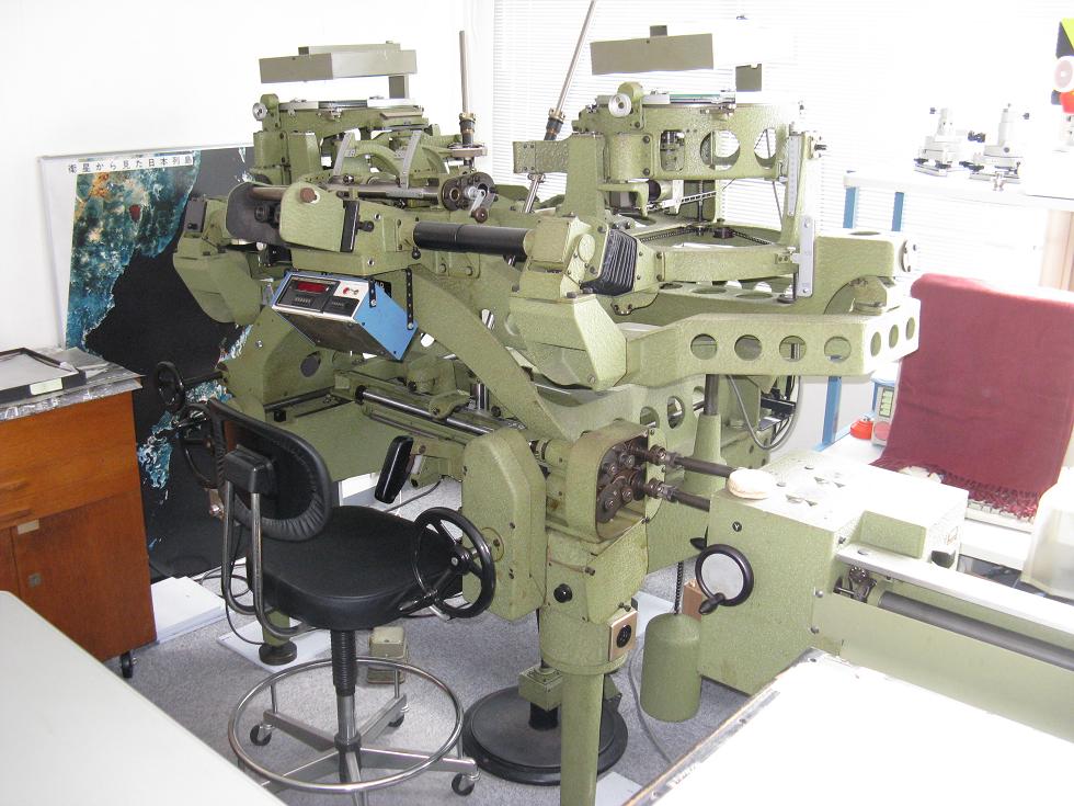
Space/Science » in reply to BTW . . .
Tell me about it.