
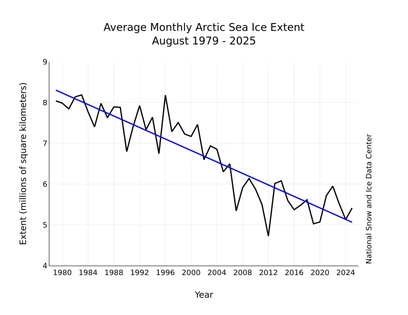
A reminder; this is the September map, comparing past August's Sea Ice Extent to all other Augusts in the satellite era. The chart covering the period of minimum, summer, Arctic ice (September) will be published
in October. I know its easy to get confused, but NSIDC needs time to process the data so we have to settle for monthly reports, at the start of the following month.
If you need data on a faster tempo, try
https://nsidc.org/sea-ice-today/sea-ice-tools/charctic-interactive-sea-ice-graph
You don't need a weatherman to know which way the wind blows.