
The more I don't believe those are "rivers" or "river valleys". There are other ways of seeing it.
Here's Daniel Crotty's mosaic from Lieken's site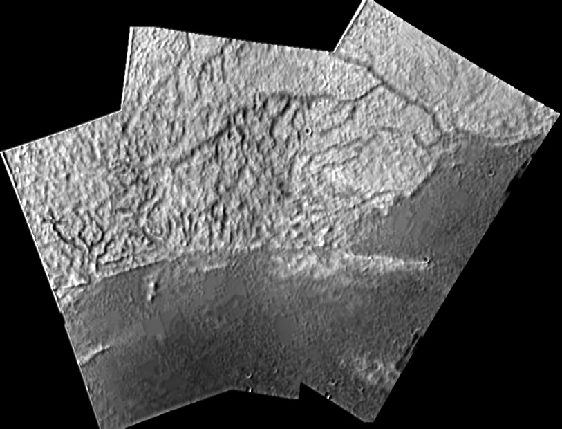
I admit, it's late, I'm tired, and I've been staring at this for too long. but there are too many odd angles. (follow the first branch of the major "river" at the upper right. Directly to the left of the bifrication at the coast there are areas that just don't make sense, river-wise.) If you stare at it long enough, you can imagine a series of uplifted blocks and the dark lines as shadows from the escarpments. The "delta" is an area of especially disrupted "ground". If it were a simple dentritic river pattern, there would be "rivers" that branched to the right. They do so at a much lower frequency than branching to the left. "Rivers" may be exploiting these structures.
I've only just started to look at some of the lower angle, more oblique images of the white "massif", which is giving me slightly different ideas. I'll stare at those tommorrow.
You can also look at it and see the darker material as intrusions into the lighter material.
Also: the dark areas are not featureless. Lots going on there...looks like smooth-surfaced, angular-outline "blocks" within the rougher areas. Are these imaging artifacts?
I agree, from this image alone, that the "shoreline" is an interface between two different materials.
Tom's observation about it looking like mountains may be partially correct. Not a fold-thrust belt like the eastern US, but perhaps a tectonic range at the interface between these two materials that are moving in response to tidal forces.
Good lord, can I arm-wave, or what? Don't hold me to any of this, I'm just thinking out loud as I cross and uncross my eyes and try to look at this in different ways.
a cross-eyed jms
The more I look at it... (contains speculations)....