
The Orrery
From the planets to the edge of the observable universe, live.
The Orrery (in the menu on the left) is a 3D map of where everything is right now, worked out from real data: NASA/JPL for the planets, moons, spacecraft and asteroids, CelesTrak for the satellites, NOAA for the Sun and space weather, the Hipparcos catalogue for the stars, and the big galaxy surveys for the universe beyond. Most of it updates itself through the day, and the alert threads here on the board feed straight into it.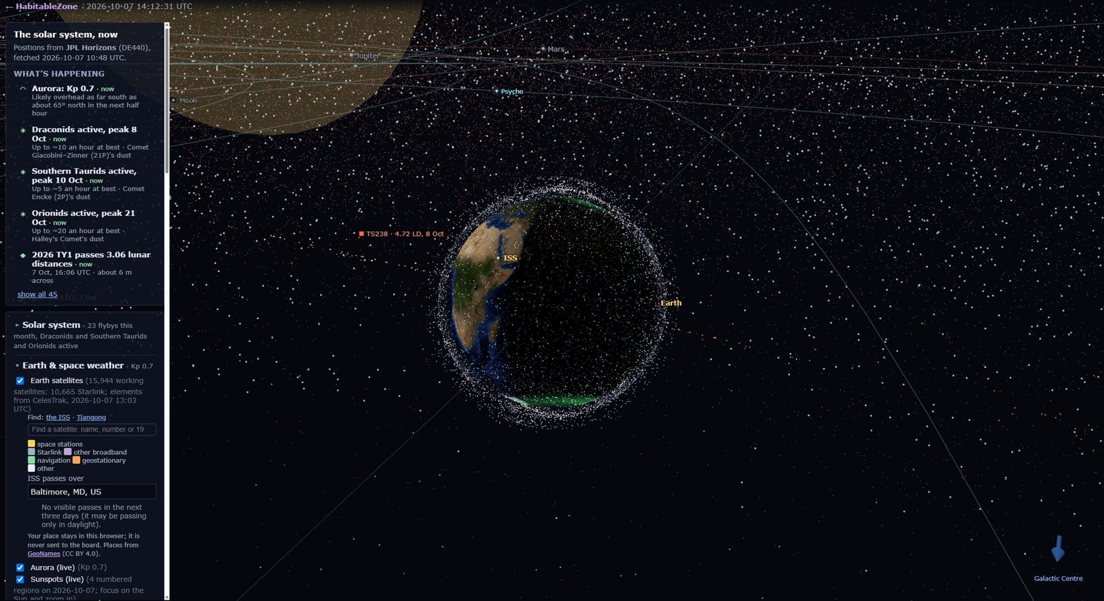
Getting around
Drag to swing the view round, scroll (or pinch, on a phone) to zoom.
Click any label (a planet, a star, a galaxy, a satellite) for its facts in the panel on the left. Clicking a planet also centres the view on it.
Go to, at the bottom of the panel, has a button for every planet and many other places. It flies there for you, from Mercury all the way out to the edge of the universe.
On a keyboard: arrow keys turn, + and − zoom, Escape takes you home to Earth.
Tip: the zoom goes a very long way. From the planets to the observable universe is about 20 powers of ten. Keep scrolling and things keep appearing.
The panel on the left has What's happening at the top, then three sections you can open and close: Solar system, Earth & space weather, and Stars & galaxies. Each has switches to show or hide its layers. The page remembers which sections you left open.
What's happening
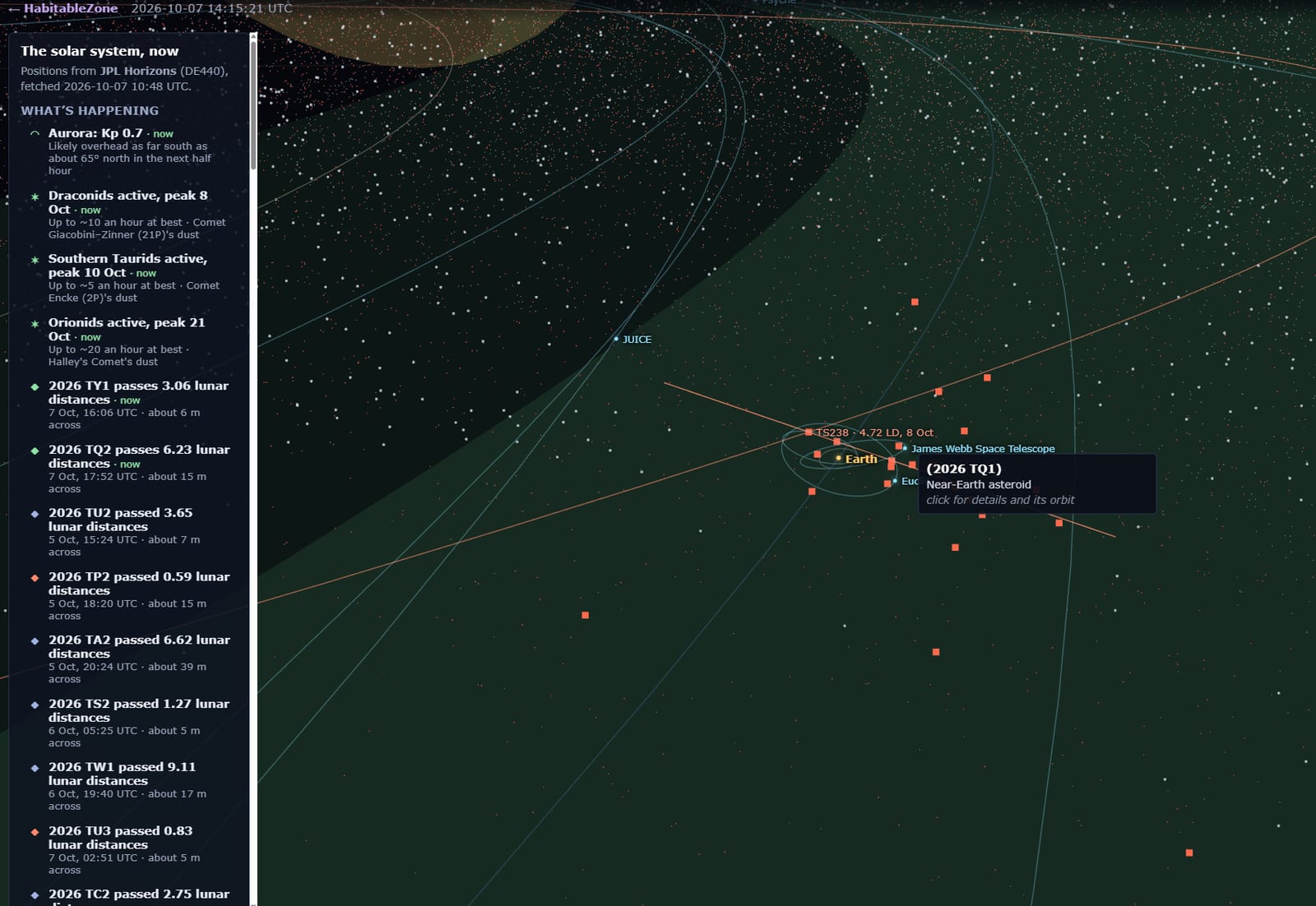
The list at the top of the panel shows what is going on now and soon. Click any item to fly to it.
Asteroid flybys: rocks passing within 10 times the Moon's distance this month (NASA/JPL), with the path past Earth and their size.
Meteor showers: the year's twelve major showers, the active ones flagged. Tick a shower to draw the dust stream Earth passes through and the comet or asteroid that left it.
Aurora: NOAA's forecast of the auroral oval over each pole, with the current Kp index. When a storm is on, you can see how far south it reaches.
Coronal mass ejections: clouds of plasma thrown off the Sun, drawn as expanding cones (yellow, orange, red as they get faster). Any heading for Earth is labelled → Earth. The most dangerous ones are posted automatically on the Space board.
ISS passes: type a town (or latitude, longitude) and it works out when the space station will be visible from there over the next three days, in local time. Your place stays in your own browser, never on the board.
The solar system
Planets and moons at their real positions, with their orbits. Click one for its facts. Positions come from NASA/JPL's Horizons system, fetched fresh every day, and your browser works out where everything is between those points, so the moons creep round their planets as you watch.
Everything turns, too. Each planet spins at its real rate and tilt (the official IAU rotation models), so Earth's day-and-night line moves across the globe in real time, Jupiter spins round in under ten hours, and the Moon keeps the same face to us, as it really does.
The habitable zone: the band round the Sun where liquid water is possible, drawn as a ring (conservative and optimistic edges).
Asteroids: about 125,000 at their real positions, near-Earth ones in red. Hover for a name, click for the orbit. "Load all 1.6 million" fetches the rest (best on a computer).
Spacecraft: Voyagers 1 and 2, New Horizons, Juno, Europa Clipper, JUICE, Parker Solar Probe, Webb and more, where they are now. Their tracks come from NASA/JPL every day too, in fine steps for the fast ones (every 5 to 15 minutes for Juno and the probes orbiting the Moon and Mars), so their positions update continuously. Click one to see the orbit it is on right now.
Kuiper belt and beyond: Eris, Sedna, Haumea and the other big worlds past Neptune, with their orbits. Further out, the Oort cloud (hypothetical, and the panel says so).
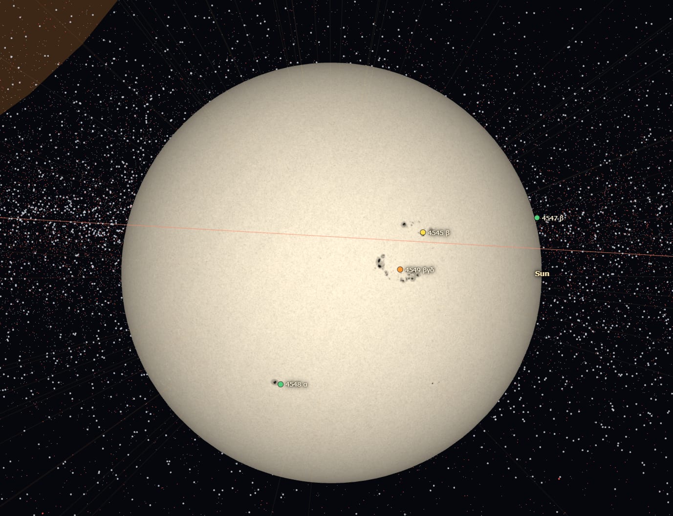
The Sun: zoom in close and the side facing Earth shows today's photograph from NASA's Solar Dynamics Observatory, refreshed every 15 minutes. Each numbered sunspot region has a coloured dot for its chance of a flare in the next day: green low, yellow, orange, red high.
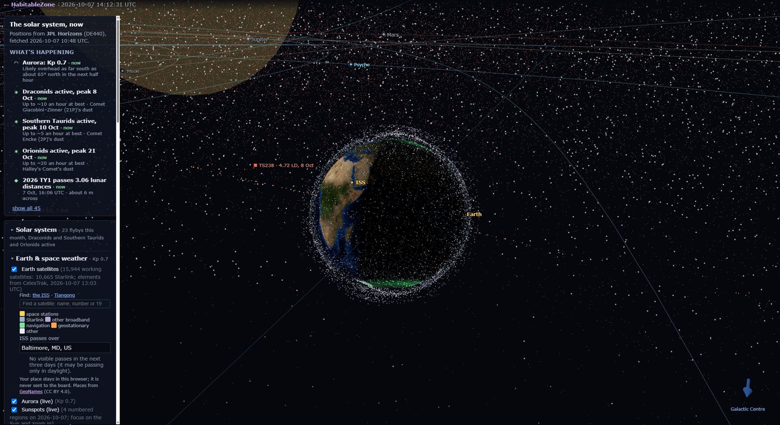
Earth and its satellites: go to Earth and zoom out a little to see all ~12,000 working satellites, coloured by kind: Starlink, navigation (GPS, Galileo…), geostationary, stations.
They move live. Every satellite is moving in real time: watch the ISS go round the world once every 92 minutes, Starlink's thousands sweep past in their shells, and the geostationary ring stay put over the equator while Earth turns beneath it. The orbital data comes from CelesTrak, which publishes the US Space Force's tracking of every active satellite; the board fetches the latest set every 6 hours. Your browser then calculates each satellite's position from its orbit with SGP4, the same standard model used by the tracking networks, refreshing every satellite about once a second.
"Find: the ISS · Tiangong" flies straight to the space stations. Click any satellite for its height, its orbit and a link to track it from your location.
The stars and the Milky Way
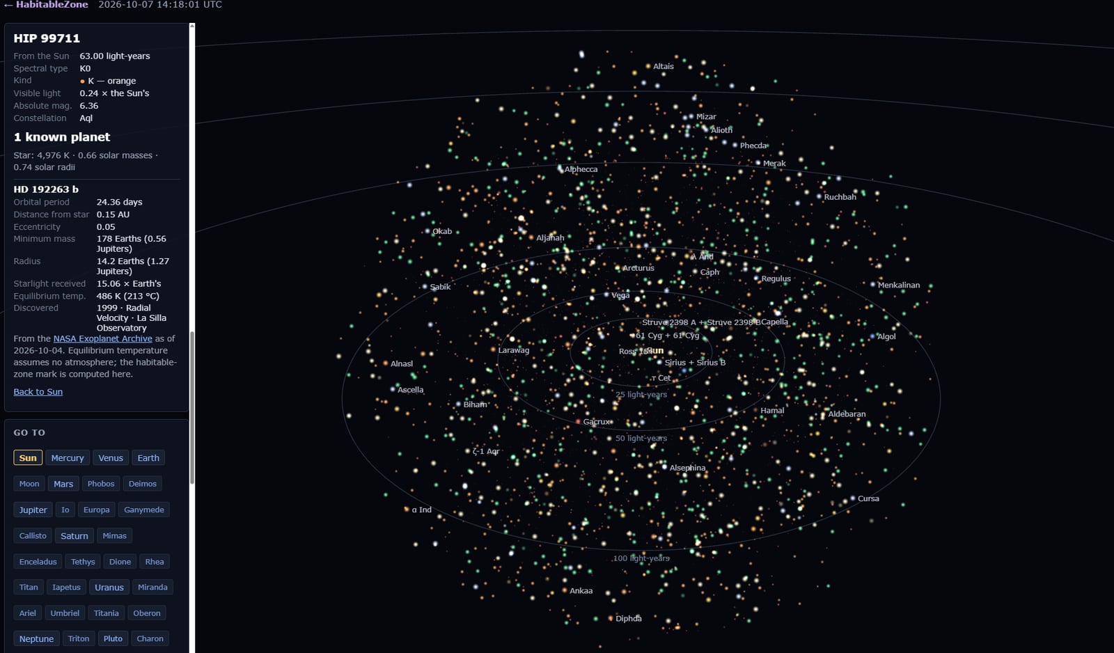
Zoom out past Neptune and the stars come in, at their true 3D positions:
within 100 light-years, every catalogued star, coloured by type (the key is in the panel);
further out, every star you can see with the naked eye, out to a few thousand light-years.
Stars that pulse have known planets. Click one for a list of its worlds from NASA's Exoplanet Archive, with a mark on any that sit in their star's habitable zone.
A translucent blue arrow in the corner always points to the centre of the Galaxy. Keep going (or use Galactic Centre or The Milky Way under Go to) and you reach Sagittarius A* and see the spiral arms from above.
Galaxies, Laniakea and the edge of everything
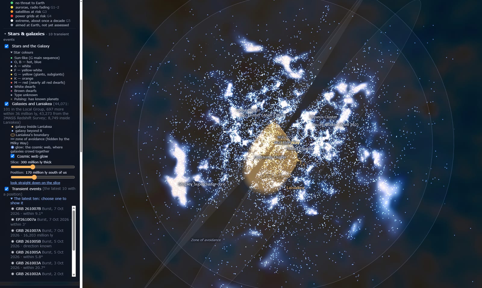
Past the Milky Way, about 44,000 real galaxies fade in from the major surveys: the Magellanic Clouds, Andromeda, the Local Group, the Virgo and Coma clusters, and the Great Attractor. The golden shell is Laniakea ("immeasurable heaven"), the supercluster we live in: every galaxy inside it is flowing towards the same place.
Galaxies hide behind one another, so the Slice sliders cut a thin sheet through space. Slide it through and the filaments and walls of the cosmic web appear. "Look straight down on the slice" gives the best view.
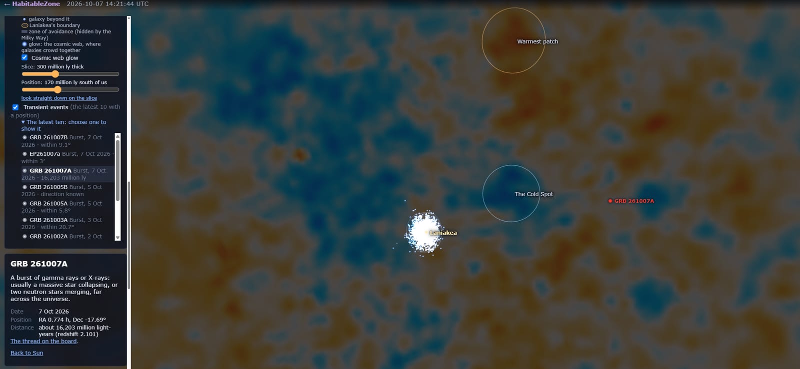
Keep going (The observable universe under Go to) and you reach the cosmic microwave background: the oldest light there is, from 380,000 years after the Big Bang. It's drawn as the inside of a sphere round us, in the Planck satellite's real map, oriented as on the sky. Three features are ringed: the Cold Spot, the warmest patch on the map, and the direction we are moving through it at 370 km/s. The zoom stops inside it, because there is nothing to see beyond.
Transient events from this board
The Transient Alerts board posts gamma-ray bursts, neutrinos, gravitational waves, bright supernovae and new comets as they are reported. The Orrery lists the latest ten that have a position (Stars & galaxies → "The latest ten"). Choose one and it is shown, flashing, with the patch of sky it could be in:
a ring for a burst's error circle;
a box for a neutrino;
for a gravitational-wave event, LIGO's actual sky map, and out among the galaxies a wedge of space with the galaxies inside it picked out.
Bursts with a measured distance sit where they are. Most are billions of light-years away, far beyond Laniakea. Choose it again to put it away. Every alert thread also has a "See it in the Orrery →" link.
A few things to try
1. Go to Earth, zoom out, and find the ISS. Then type your town under ISS passes.
2. Click the Sun, zoom in, and read the flare odds on today's sunspots.
3. Zoom out to 100 light-years and click a pulsing star.
4. Go to Laniakea, set the slice to its thinnest, and slide it through.
5. Go to the observable universe and find the Cold Spot.
Everything you see is real data, recomputed in your own browser from the orbits and catalogues, so it is right now, not a picture. Questions, ideas and bug reports are welcome in this thread.